The Winnipeg Free Press would like to show you notifications for breaking news and noteworthy local journalism.
No Thanks
Allow
Notification Settings
This browser doesn't support push notifications at the moment. Check browsers features, update your browser or try to use one from the list of recommended to manage your notifications settings:
Firefox (27+)
Google Chrome (30+)
Safari ( MacOS 13+ with browser 16.1+ and iOS 16.4+ ) / Note make sure Push API support enabled under Settings > Safari > Advanced > Experimental Features
Microsoft Edge
If you wish to manage your notification settings from this browser you will need to update your browser's settings for this site. Just click button below and allow notifications for this site
Note Safari 16.4+ working on iOS devices also need this site app to be installed at device's Home Screen for Push Notifications to work
Notifications are blocked for this site. If you wish to manage your notification settings from this browser you will need to update your browser's settings. Usually you'd need to click on site options icon to the left of address bar and change notifications preferences/permissions from there
We need your support! Local journalism needs your support!
As we navigate through unprecedented times, our journalists are working harder than ever to bring you the latest local updates to keep you safe and informed.
Now, more than ever, we need your support.
Starting at $14.99 plus taxes every four weeks you can access your Brandon Sun online and full access to all content as it appears on our website.
Hey there, time traveller!
This article was published 24/03/2011 (4775 days ago), so information in it may no longer be current.
Dirk Aberson / Brandon Sun file
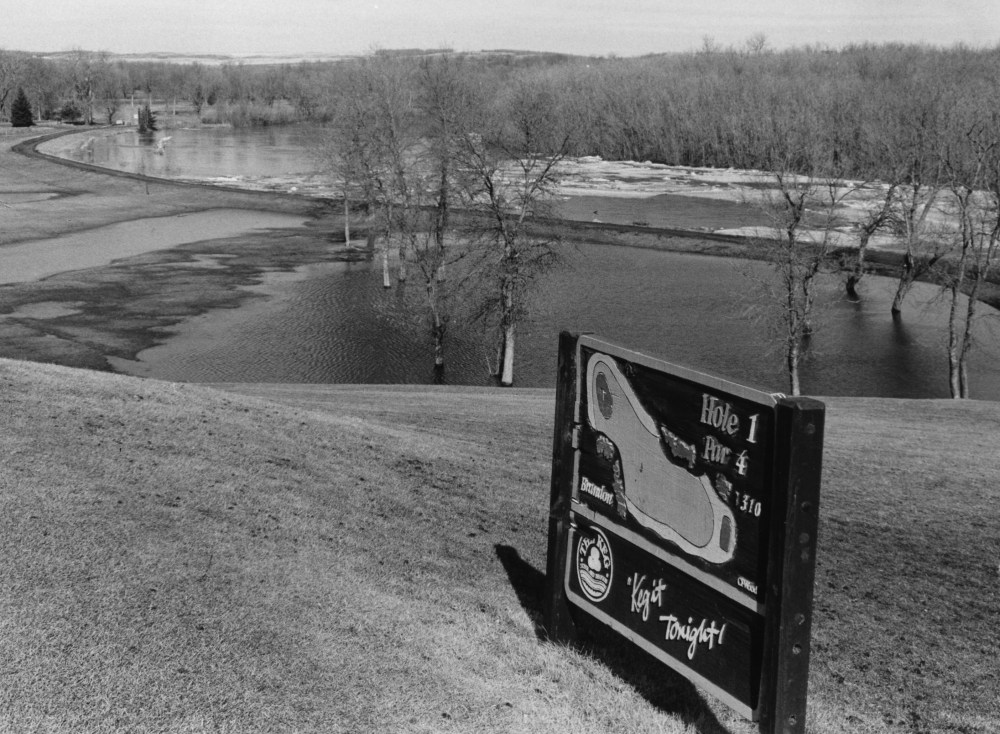
Brandon City golf course, as seen from the first tee during flooding in April 1995. High water in the Assiniboine hadn't yet flooded over the course, and greenskeeper Lloyd Erickson said that if the water remained at its current level and run-off water is pumped out, the course may be open by April 15, that year.Dirk Aberson / Brandon Sun file
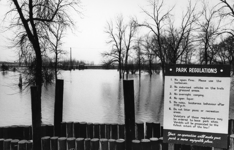
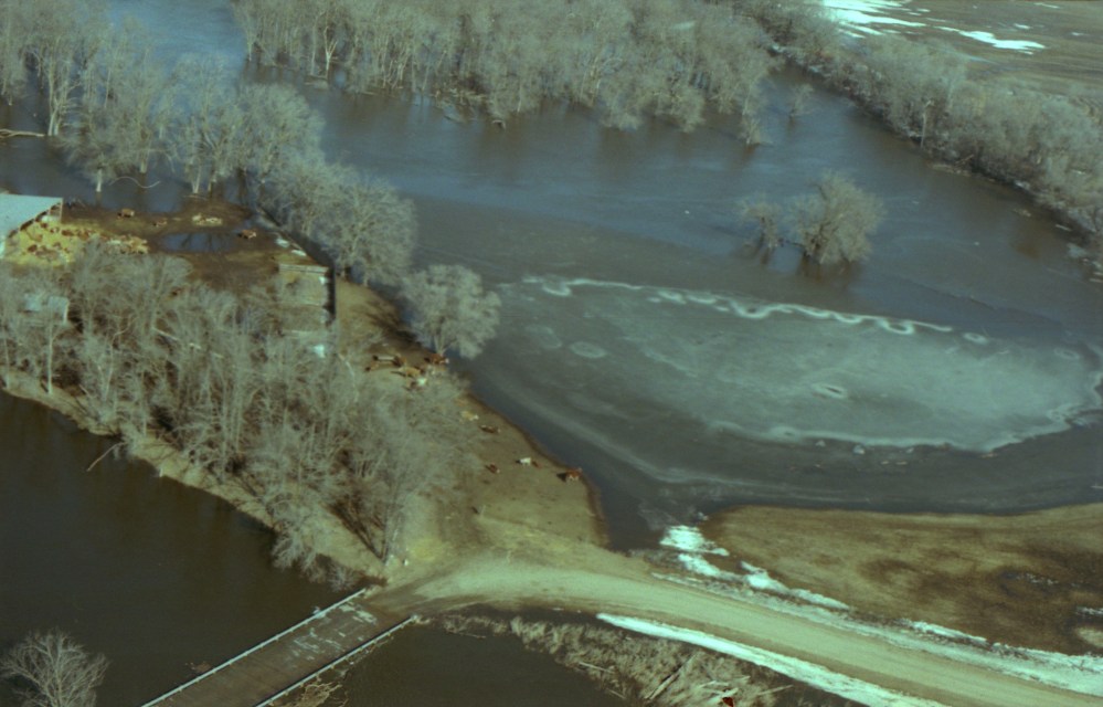
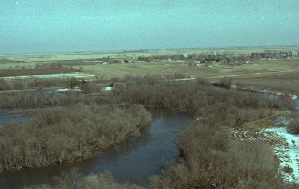
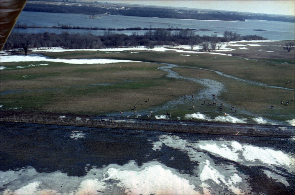
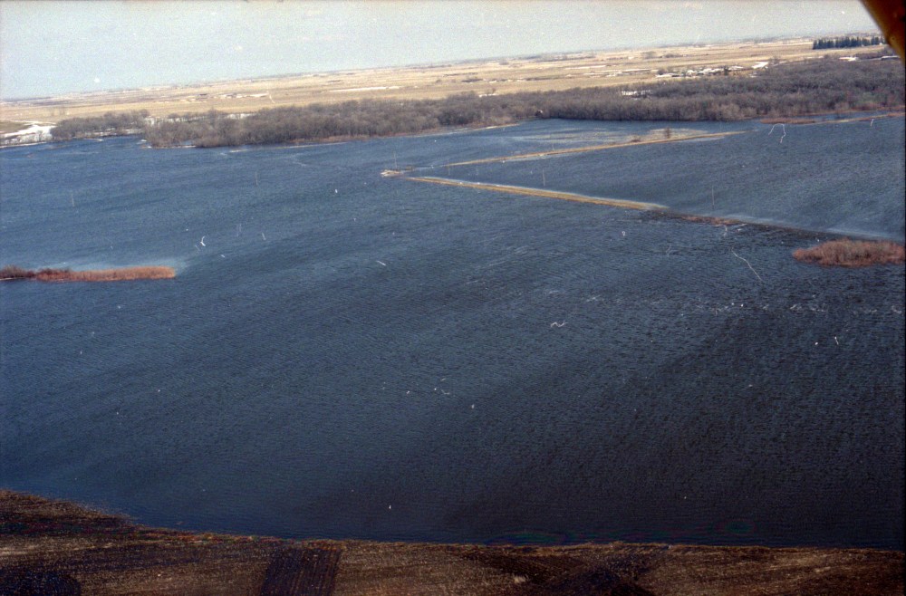
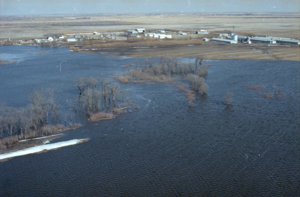
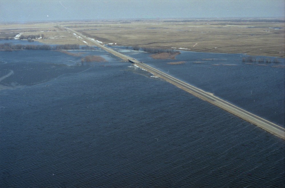
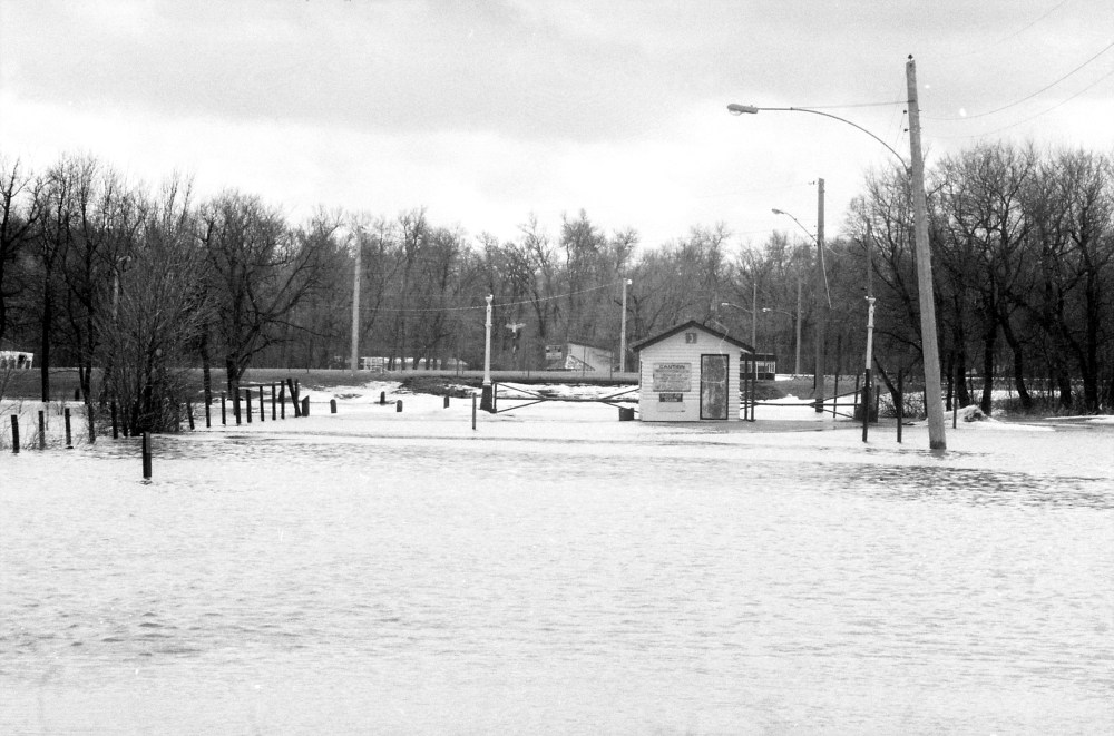
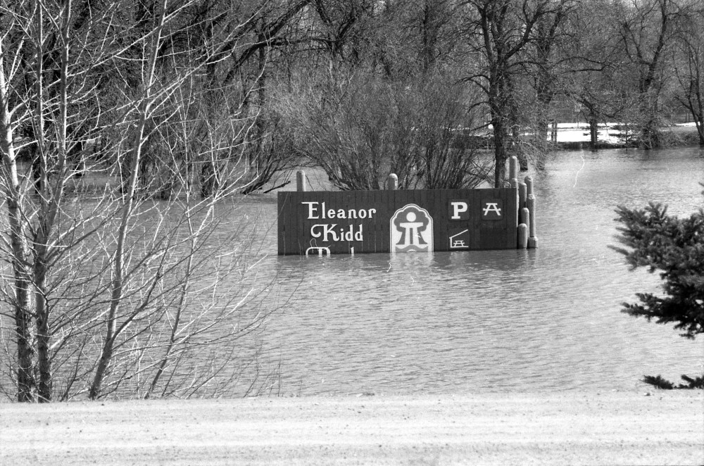
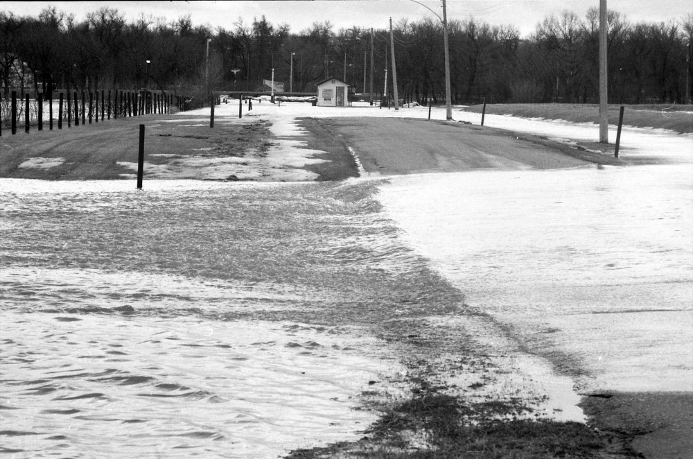
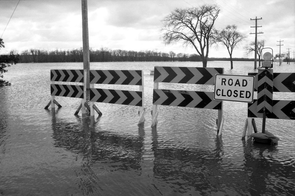
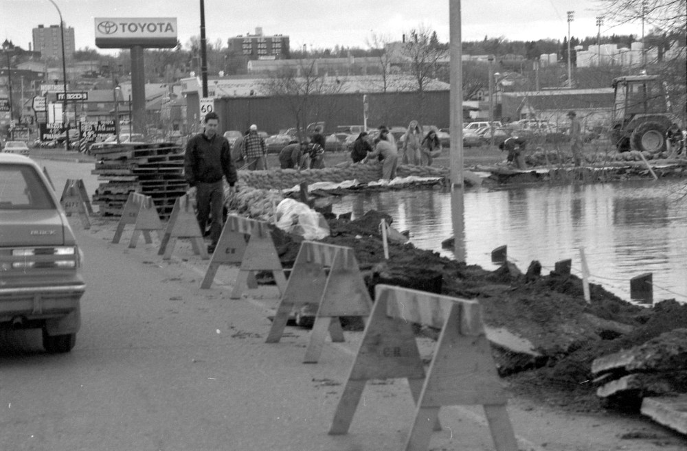
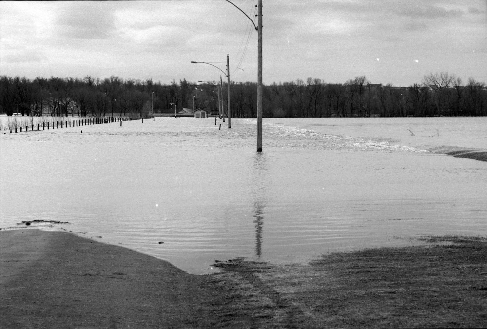
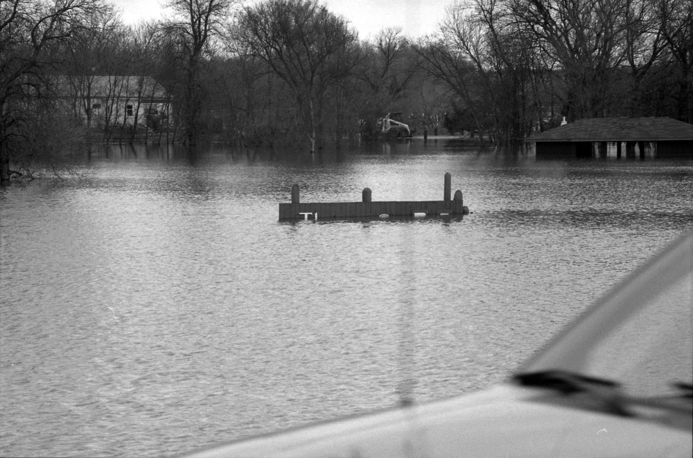
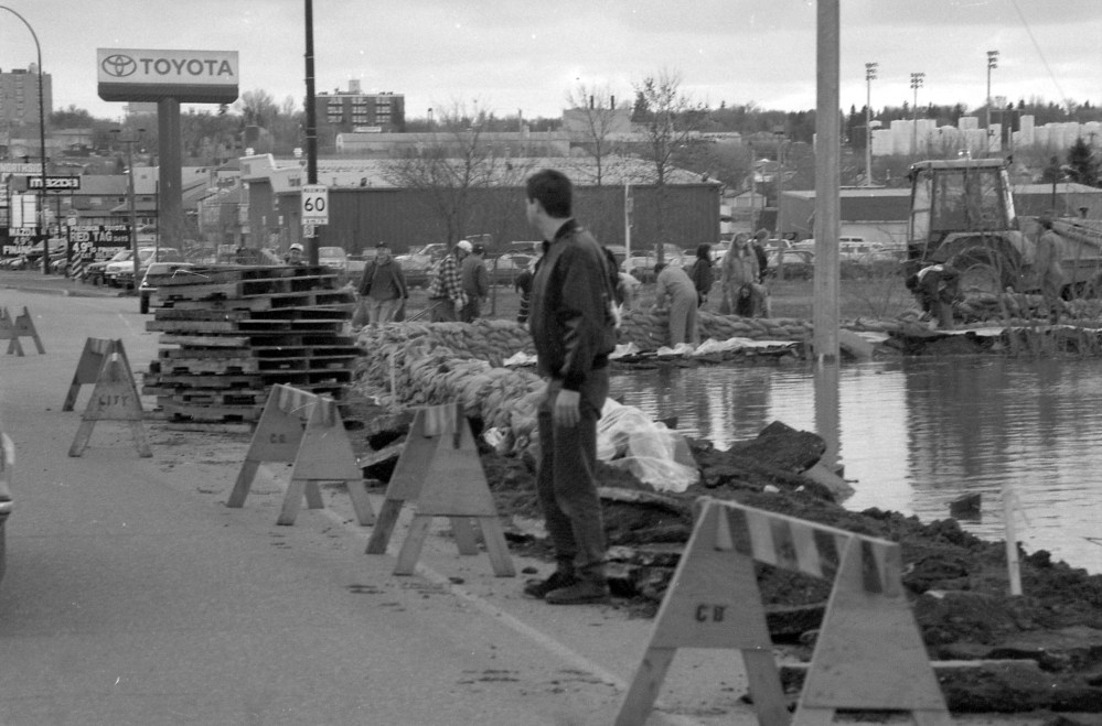
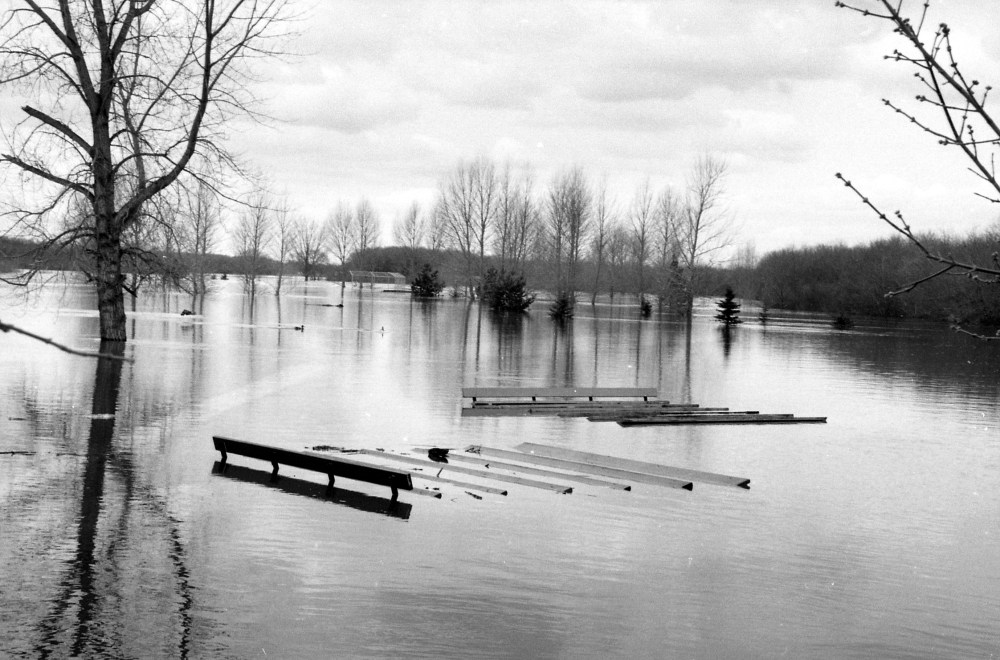
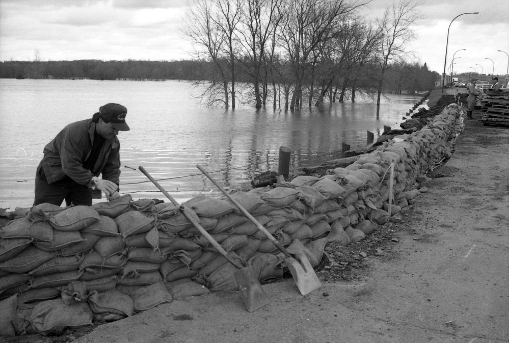
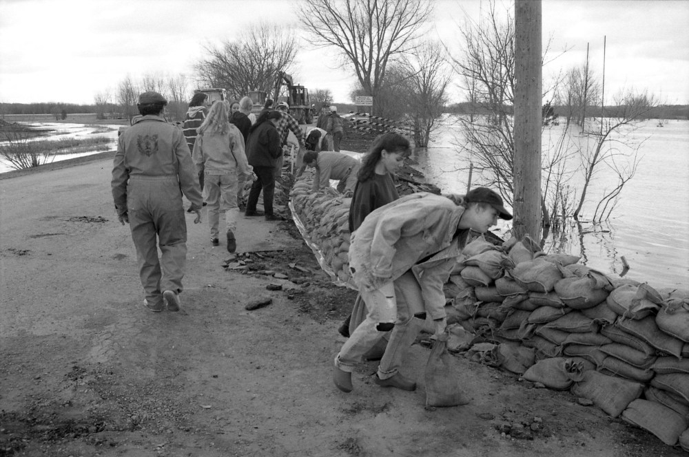
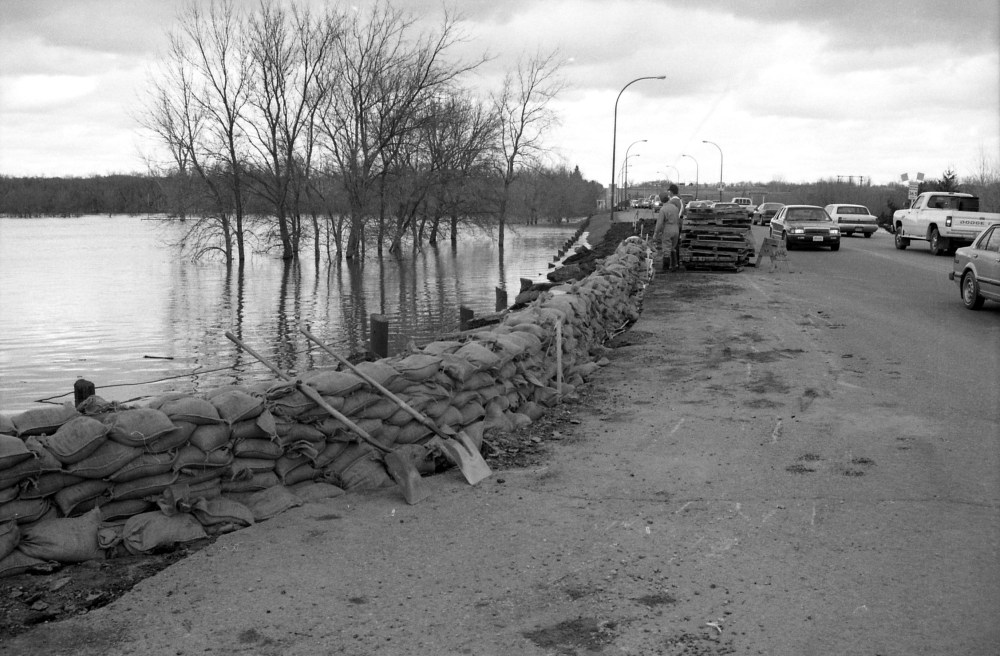
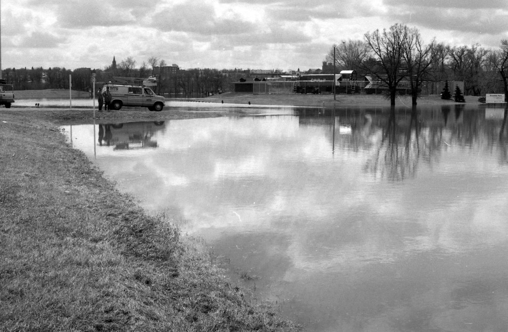
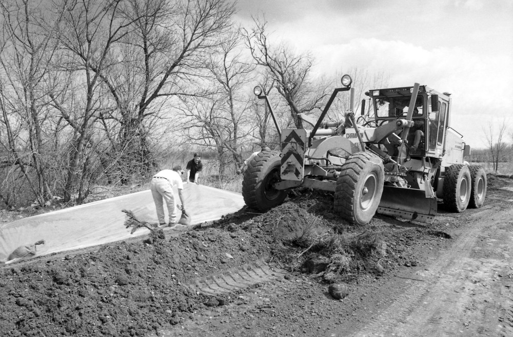
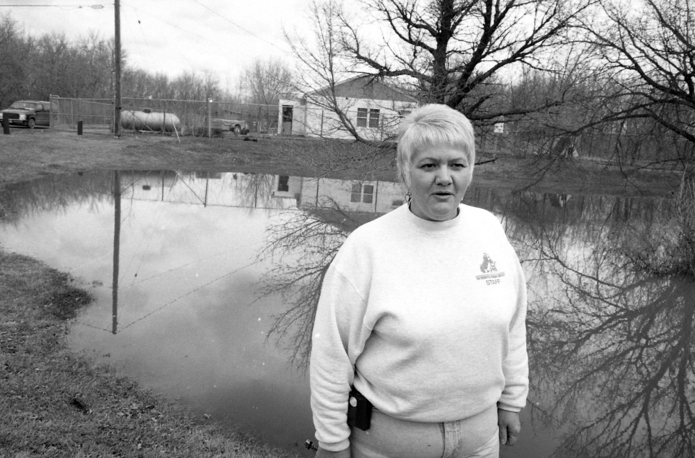
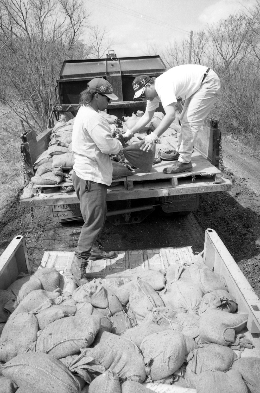
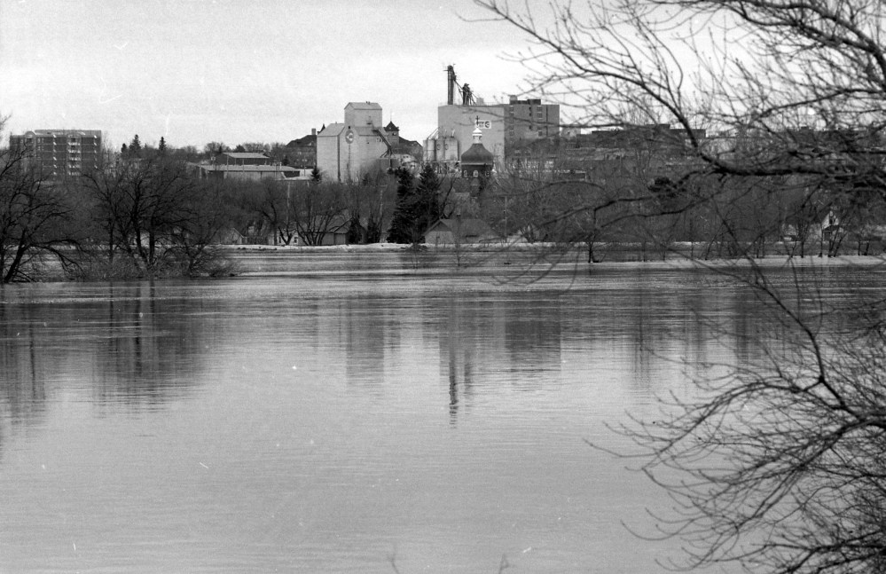
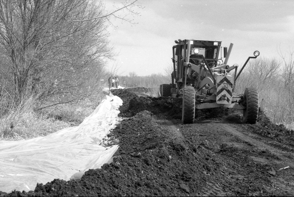
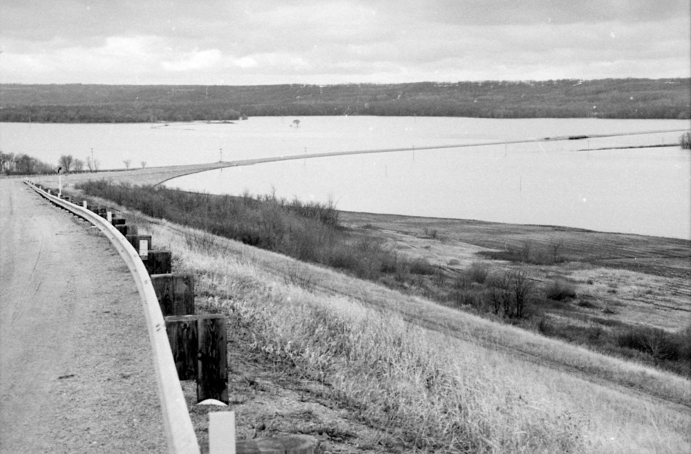
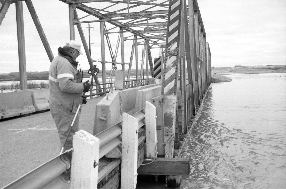
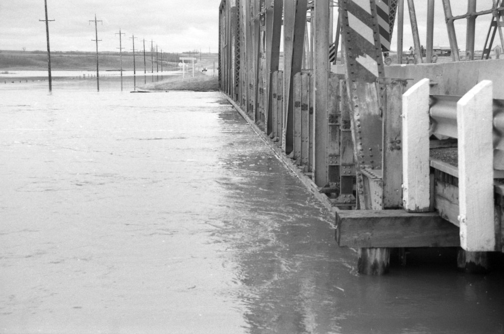
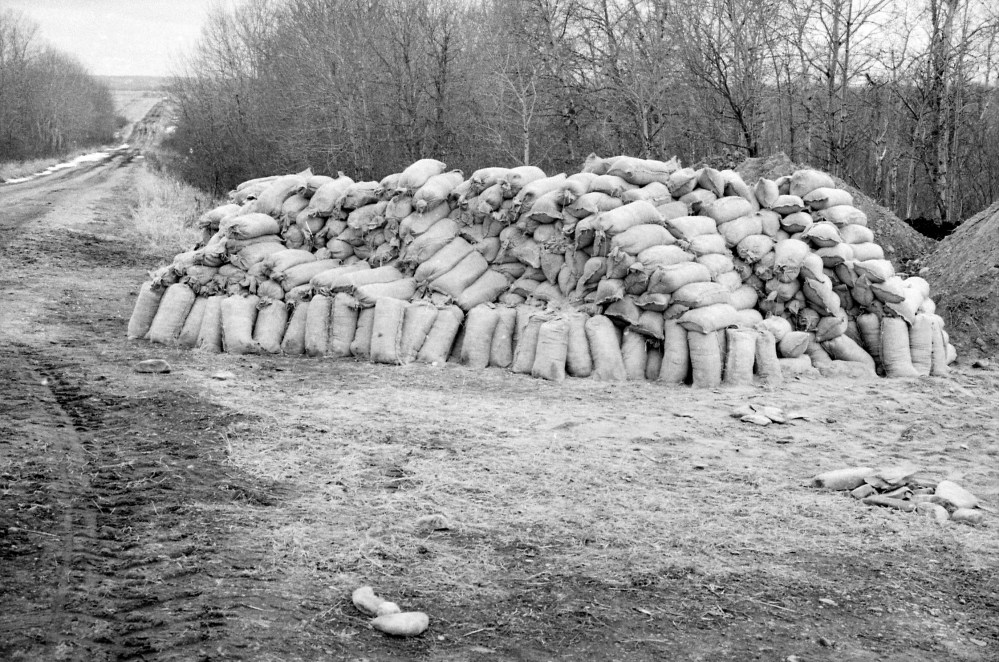
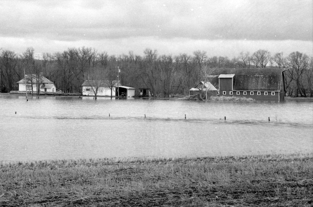
Eleanor Kidd Park, looking towards 18th Street, during April 1995.Ice and rising floodwaters surround cattle at a farm in the Souris or Melita area. (Dirk Aberson / Brandon Sun archives, April 12, 1995)Rising floodwaters are seen from the air in the Souris or Melita area. (Dirk Aberson / Brandon Sun archives, April 12, 1995)A flooded river is seen from the air in this photo taken during the 1995 spring floods in the Souris and Melita areas. (Dirk Aberson / Brandon Sun archives, April 12, 1995)A flooded river is seen from the air in this photo taken during the 1995 spring floods in the Souris and Melita areas. (Dirk Aberson / Brandon Sun archives, April 12, 1995)A flooded river is seen from the air in this photo taken during the 1995 spring floods in the Souris and Melita areas. (Dirk Aberson / Brandon Sun archives, April 12, 1995)A bridge on the road shows where the river would normally by, in this view from the air taken during the 1995 spring floods in the Souris and Melita areas. (Dirk Aberson / Brandon Sun archives, April 12, 1995)Floodwaters wash over the entrance road to Curran Park, now Turtle Crossing, during the 1995 Assiniboine River flood. (Dirk Aberson / Brandon Sun archives, April 18, 1995)The sign to Eleanor Kidd Park, then home to the Brandon Humane Society, is partially submerged during the 1995 Assiniboine River floods. (Dirk Aberson / Brandon Sun archives, April 18, 1995)Floodwaters wash over the entrance road to Curran Park, now Turtle Crossing, during the 1995 Assiniboine River flood. (Dirk Aberson / Brandon Sun archives, April 18, 1995)Grand Valley Road is closed. Seen looking southwest from near 18 Street North. (Drik Aberson / Brandon Sun archives, April 25, 1995.)A sandbag dike is built up at the corner of 18th Street North and John Avenue. (Dirk Aberson / Brandon Sun archives, April 25, 1995)The entrance road to Curran Park, now Turtle Crossing, is completely flooded. (Dirk Aberson / Brandon Sun archives, April 25, 1995)Flooding nearly covers the top of the sign marking Eleanor Kidd Park during the 1995 Assiniboine River flood. The sandbagged building that at that time housed the Brandon Humane Society is seen through the trees at left. (Drik Aberson / Brandon Sun archives, April 25, 1995.)Workers build up the sandbag dike at 18th Street North and John Avenue. (Dirk Aberson / Brandon Sun archives, April 25, 1995)Assiniboine River floodwaters swamp grandstands during the 1995 flooding. Location is probably the Participaction Park, now Pooch Park. (Dirk Aberson / Brandon Sun archives, April 24, 1995)Workers build up a sandbag dike at the intersection of John Avenue and 18th Street North. (Dirk Aberson / Brandon Sun archives, April 25, 1995)Volutneers help build up the sandbag dike at 18th Street North and John Avenue. (Dirk Aberson / Brandon Sun archives, April 25, 1995)A wall of sandbags protects 18th Street North, at John Avenue, from the rising Assiniboine. The old Thompson Bridge can be seen behind the pile of pallets. (Dirk Aberson / Brandon Sun archives, April 25, 1995)MTS staff work in the flooded Dinsdale Park. (Dirk Aberson / Brandon Sun archives, April 24, 1995)A grader and sandbaggers work on the roads during the 1995 flood fight. (Dirk Aberson/ Brandon Sun archives, April 24, 1995)A staff member at the Brandon Humane Society stands outside what was then the society's headquarters, located in perennially-flooded Eleanor Kidd Park. (Dirk Aberson / Brandon Sun archives, April 24, 1995)Sandbags are loaded into a truck during the 1995 flood fight along the Assiniboine River. (Dirk Aberson / Brandon Sun archives, April 24, 1995)Looking south or south-east over the Assiniboine River, which has spilled its banks, towards central Brandon. (Dirk Aberson / Brandon Sun archives, April 28, 1995)A grader works on the roads during the 1995 flood fight. (Dirk Aberson/ Brandon Sun archives, April 24, 1995)The road is a thin strip of dry land, through a flooded-out valley. The precise location isn't certain. The image is from a roll of photos identified only as "Kenton Lenore" from April 27, 1995. (Dirk Aberson / Brandon Sun archives)Water flows right up to the bottom of this unidentified bridge, on a roll of photos identified only as "Kenton Lenore" from April 27, 1995. (Dirk Aberson / Brandon Sun archives)Water flows right up to the bottom of this unidentified bridge, on a roll of photos identified only as "Kenton Lenore" from April 27, 1995. (Dirk Aberson / Brandon Sun archives)A sandbag stockpile sits ready for use along a rural Manitoba road. The precise location isn't certain; the image is from a roll of photos identified only as "Kenton Lenore" from April 27, 1995. (Dirk Aberson / Brandon Sun archives)A barn sits partially submerged, although the house, at left, is protected by sandbags. The precise location isn't certain; the image is from a roll of photos identified only as "Kenton Lenore" from April 27, 1995. (Dirk Aberson / Brandon Sun archives)